
Overview
Sarah Cox, Partner at Carter Jonas discusses 3D planning insights. Exploring innovative strategies and solutions for effective three-dimensional planning that transform projects.
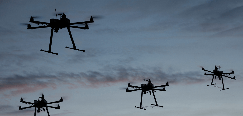
Picture a neighbourhood in 2036. A drone carries pathology samples towards a hospital while another inspects a nearby railway bridge. Parcels arrive by air at a local delivery hub. An electric air taxi approaches a landing site, while wireless networks connect vehicles, buildings and the people moving between them. Some of that activity will be visible; much of the connectivity supporting it will not.
This is a likely future just a decade from now, based on some reliable predictions, including the Civil Aviation Authority (CAA) forecasting that the eVTOL Delivery Model to enable commercial passenger operations will occur from the end of 2028.
So, although the near future may not unfold exactly as predicted above, it is close enough to warrant attention from planning and development professionals now.
It’s an exciting prospect, but one that calls for a more coordinated planning response. Planning policy has largely evolved around land use, while the technologies now emerging depend upon both land and airspace operating together. As airspace becomes an ever-increasing planning issue, development consultancy and strategic planning need to consider those relationships more consistently.
Sarah Cox
Partner, Head of Planning North
MRTPI

Airspace is the new infrastructure challenge
Having previously worked for Vodafone, I have seen planning from a network operator’s perspective as well as a consultant’s. Telecommunications planning and expert witness work have reinforced my interest in how infrastructure makes places function. The challenge now is allowing the built environment to change so that new technologies can evolve, while protecting what people value about their surroundings.
The physical demands are already growing. Ofcom’s Connected Nations 2025 report records 1,257 petabytes of mobile data traffic in July 2025, up 18% in a year. Traffic over 5G increased by 53%. Reliable networks support much more than phones: healthcare, building management, industrial equipment, logistics and transport services increasingly use wireless connectivity.
Heavier use means greater capacity is needed where demand concentrates, alongside coverage where service is inadequate. A coloured coverage map cannot tell us whether a network will meet the demands of a new neighbourhood. For example, Ofcom’s Connected Nations 2025 report states that the higher-threshold measure of good outdoor mobile coverage reaches 88% of UK landmass from at least one operator, compared with 96% under its established 4G coverage measure.
Aircraft movements and radio transmissions are two very different uses (of which there are many) of the space above us and they are governed by different technical requirements. Their infrastructure nevertheless intersects with development. A building can obstruct a microwave link or helicopter approach; a landing site or mast can affect neighbouring land’s development potential.
Drones are bringing the future closer
The CAA’s National Aviation Safety Plan records approximately 745,275 active flyer and operator IDs in February 2025, a 32.6% annual increase.
Future potential is larger still: PwC’s 2022 Skies Without Limits research modelled a best-case scenario of more than 900,000 commercial drones operating in UK skies by 2030, contributing up to £45 billion to the economy.
The applications extend well beyond parcel delivery. The Government policy paper Advancing airborne autonomy: use of commercial drones in the UK encompasses infrastructure inspection, surveying, agriculture and emergency services. Medical deliveries, environmental monitoring and construction inspections bring different benefits and operating requirements. The CAA’s Future of Flight BVLOS Roadmap works towards routine operations beyond the pilot’s visual line of sight by 2027.
For planners, the question is how to accommodate the facilities these services need, from dispatch hubs to landing areas, while assessing their effects on surrounding places. We need to enable innovation without treating every proposed application as inevitable or beneficial everywhere.
Local plans need to connect the policies
Many local plans already contain relevant policies. A desk-based review of 22 Yorkshire planning frameworks carried out for this article found telecommunications and established aviation considerations across infrastructure, design, renewable-energy and safeguarding policies.
Some provisions are particularly useful: Wakefield’s SP20 addresses connectivity and mitigation where development reduces surrounding mobile coverage or harms existing infrastructure; Bradford’s aircraft-safety policy is supported by text recognising hospital helicopter landing sites, and the Peak District DMT9 expressly includes drones, although it manages their effects rather than planning a commercial network.
However, relatively few of the frameworks examined appeared to draw these different strands together into a coherent basis for decision-making. Explicit preparation for commercial drone networks and vertiports was also much less evident in the principal adopted texts examined. The challenge is to connect existing policies on aviation safeguarding, telecommunications and building heights and ensure that those provisions are sufficiently adaptable to accommodate emerging technologies.
Land allocations alone cannot secure economic growth if the infrastructure needed to make them work is overlooked. Plan-making should bring operators and technical specialists into discussions about growth locations, infrastructure opportunities and potential conflicts early enough to influence decisions.
Local plans can have planning horizons stretching as much as two decades beyond their earliest drafts. As the description above suggests, use of airspace may change substantially within that timeframe. Furthermore, accurate forecasts of every future use are unrealistic; policies need flexibility, monitoring and mechanisms for responding to new evidence – possibly sooner than is predicted.
Practical implications for design could mean considering rooftop equipment when setting design expectations, assessing communications links alongside proposed building heights and identifying where new infrastructure could be accommodated without prejudicing neighbouring development. Site-specific requirements should respond to evidence, with enough room for upgrades. It is a practical way to prepare for change without trying to prescribe the technology of 2040.
Applying the planning balance
The principles governing planning should remain consistent: planning must balance widespread need with landscape, heritage, design and amenity considerations. Infrastructure can be essential and still visually challenging. The task is to find a workable response, supported by evidence.
A good planning consultant will understand why an operator needs a specific location, then explore how planning and design can make it fit. It requires curiosity about the technology and respect for the place.
The revised NPPF gives substantial weight to improvements in network coverage, capacity, reliability and resilience. It encourages existing structures to be used where reasonably possible and visual effects to be minimised with regard to operational requirements. It also protects air traffic services and nationally important instrumentation from significant and irremediable interference.
A shorter mast or secluded location may look preferable but fail to provide equivalent service. The Government’s wireless development code identifies coverage, capacity and connections to the core network as key considerations. Microwave links require clear lines of sight. Alternatives need testing against those requirements, not simply comparing photographs.
Sharing structures and integrating equipment into buildings can improve a scheme, provided maintenance and future upgrades remain possible. Equally, technical necessity should be explained clearly rather than used to close down discussion. Local experience can expose assumptions about noise, visibility or operating patterns that deserve investigation.
The CAA’s recent research Managing Noise from Emerging Aviation warns that quieter aircraft can still create new disturbance through frequent movements, lower flight paths and proximity to homes. The purpose and intensity of operations matter: an emergency medical service and a regular commercial delivery operation require different planning cases.
From technical requirements to property decisions
Carter Jonas’s work with the helipad at Leeds Teaching Hospitals illustrates the importance of considering surrounding development. Hospital landing facilities are vital in supporting urgent access to care, but buildings, rooftop equipment, trees and construction cranes can affect approaches and the flexibility available in different weather conditions.
The relationship works both ways. A proposed landing facility must consider neighbouring permissions and development aspirations. Before fixing heights and layouts, developers should identify relevant infrastructure, engage its operators and establish where design can respond. Early coordination offers more opportunity to improve a scheme than discovering a conflict after its main decisions have been made.
These are property questions as well as planning questions: equipment needs land rights, access and maintenance arrangements; accommodating it may affect future redevelopment and value. Carter Jonas combines telecommunications planning and expert witness experience with specialist valuation advice for landowners, helping operators and owners understand those implications together.
An exciting direction for planning
In my experience, authorities and consultancies could do more to bring their existing expertise together and anticipate greater demand above ground. Building awareness of how land use, telecommunications and aviation interact should be a priority for development teams and plan-makers alike.
Planning is facing a recruitment crisis, but this is a compelling part of its future, which could attract people who have never considered the profession.
I see airspace as one of the most exciting areas of planning in the 21st century. The neighbourhood imagined for 2036 will depend on decisions about buildings, infrastructure and their neighbours made much earlier, and it is planning alone that can shape those relationships. We should be developing and applying them now.
Research and insights
 Read insight
The UK has Industrial and Infrastructure strategies
Explore how the UK's Industrial and Infrastructure strategies shape economic growth. Carter Jonas provides expert insights on policy impacts and investment opportunities.
 Read insight
Data Centres Without the Drama
Discover how Carter Jonas simplifies data centre solutions, delivering expert property advice without the complexity. Explore smarter, stress-free data centre strategies today.
 Read insight
A Future for Historic Buildings
Discover how Carter Jonas helps secure a future for historic buildings with expert heritage property advice, preservation strategies, and specialist real estate solutions.
Tailored newsletters for you
Sign up to our newsletter to receive further information and news tailored to you.