Measured Survey
The Carter Jonas measured survey capability supports all scales of project, from strategic land development and major infrastructure projects through to the smallest topographic, measured building and utilities surveys.
We pride ourselves on being at the forefront of technology and offer innovative techniques for data collection, visualisation and real time reporting.
Our measured survey services
Our measured survey services range from boundary surveys though to digital twins, all with the newest technology and best customer service.
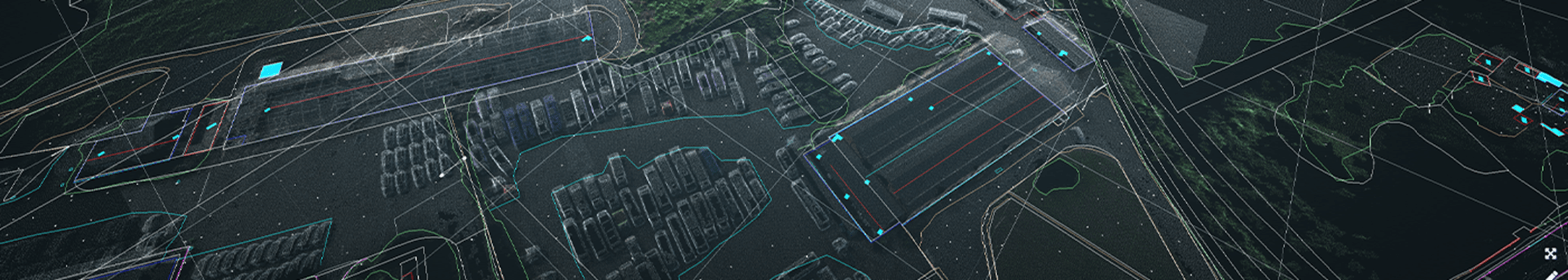
Aerial mapping
Carter Jonas employs a range of drones and sensors to provide high resolution imagery, video, and point cloud data.
UAV (unmanned aerial vehicle) data can be used to complement traditional survey techniques, offering considerable time savings on site.
Data can be used to create 3D models and drawings and to help monitor and assess the condition of assets.
Topographical & measured building surveys
Topographical and measured building surveys often form the base information from which architects, engineers and planners work. Our surveyors have a wealth of experience producing surveys ranging from small private properties to major buildings or sites covering many hectares.
Surveys can be delivered in a range of formats to suit the client’s needs.
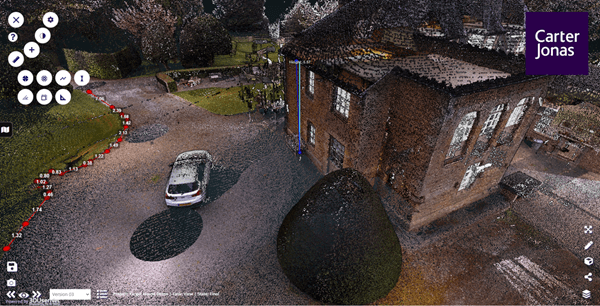
BIM (Building Information Modelling) & digital twins
Combining our measured survey and GIS capability allows Carter Jonas to provide the latest “Digital Twin” solutions.
BIM datasets overlaid with site and condition survey information provide the next generation of property and estate management services.
Digital twins provide complete situational awareness for the management of daily operations and the ability to conduct planning and simulation.
Boundary surveys, land registry plans and disputes
Our surveyors have an in depth understanding of the principles and procedures relating to boundary identification and the production of plans compliant to Land Registry standards.
Consent for building in our highly constrained landscape relies on establishing accurate boundaries. Where a client wishes to dispose of land, we can produce title plans identifying the parcel of land to be sold and establish boundaries on site.
Pressure on land use and continuous development means that boundary disputes are becoming increasingly common, and our team of chartered surveyors can assist in the event of a dispute.
Read ‘Boundary disputes: Your questions answered’ >
Mobile mapping
For large sites or where access is an issue, Carter Jonas can offer vehicle mounted mobile mapping solutions.
Pointcloud data can be collected from a moving vehicle at normal road speeds removing the need for costly and time-consuming traffic management, while ensuring the safety of staff by removing them from work in high-risk areas.
Mobile mapping offers a rapid data collection solution while providing highly accurate data.
Structural & environmental monitoring
Carter Jonas can offer monitoring solutions ranging from simple manual measurement through to fully automated systems.
Results can be delivered via web portal and available to be viewed in real time by any number of stakeholders.
Utility mapping
Our underground utility mapping service allows verification and precise location of buried services with surveys conducted in accordance with the PAS128:2104 standard.
Results from our utility surveys can be marked out on site, used to produce plans or combined with other datasets to produce a full 3D model showing above and below ground features.